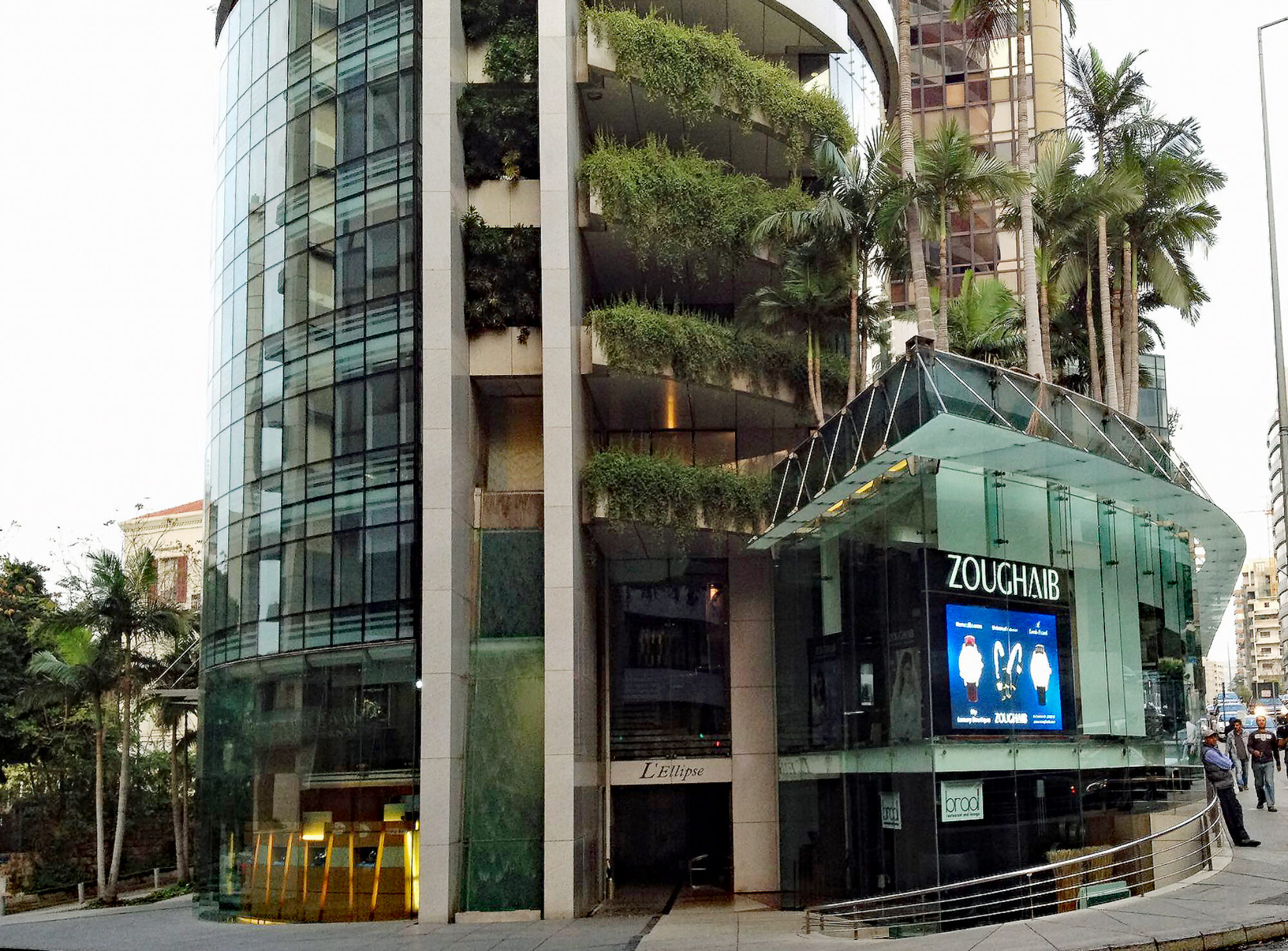


l’ellipse center mixed-use tower (retails, offices & lofts)
L’ellipse center is an achievement with unique architectural concept that complies with the European Standards: Franck HAMMOUTENE – PARIS and Groupe ARCHIPOLIS ( BERNARD COSTA) – PARIS Architects SOCOTEC-Paris (Control) GEMO- Paris (Organization) LE MUR EN VERRE-PARIS (Spider glass). ETEC-Lebanon (Structural,electrical and mechanical design). L’ellipse center (bloc Trapeze & bloc L’ellipse) this building Includes:shops, offices …
Continue reading “l’ellipse center mixed-use tower (retails, offices & lofts)”
soulouj laqlouq
Le Commerce du Levant Feb. 2012 Tous droit reserves à Le Commerce du Levant [gview file=”https://www.comair.me/commercedulevant.pdf” profile=”null”]
l’ellipse center Roof
Deco Magazine July 2012 Tous droit reserves à Deco Magazine [gview file=”https://www.comair.me/comaird49.pdf”]
urban study (thesis DESA)
[dl url=”http://comair.me/Pres.exe” title=”Download ” desc=”Introduction.exe” type=”” align=””][dl url=”https://www.comair.me/PPT2.exe” title=”Download Slide ” desc=”PowerPoint.exe” type=”” align=””][dl url=”http://comair.me/3_montage.exe” title=”Download ” desc=”Montage.exe” type=”” align=””] This work is licensed under a Creative Commons Attribution-NonCommercial-ShareAlike 3.0 Unported License. Space woody to the Lebanon have been savagely position by the expansion of the construction. It remains now 4.8% of dense forests of …

This work is licensed under a Creative Commons Attribution-NonCommercial-ShareAlike 3.0 Unported License.
Space woody to the Lebanon have been savagely position by the expansion of the construction. It remains now 4.8% of dense forests of what was called the Green country. This wealth is concentrated mainly in 18 watersheds * sequencing the coastline. With the increase and intensification of urbanization, new dimensions have emerged. The valleys become green cuts in this urban environment and thus a crucial link in development across a wide territory.
Near major cities and available to all, the valleys can accommodate public spaces. Is there a certain management system that will bring these rich lands and Woody in values?
The water catchment area of Nahr el Kalb * is a geographical entity and landscape distinct. In my analysis, I have opted for the lower part of the Valley, focusing issues and exposed to the highest land pressures due to the proximity to the capital.
The Nahr el Kalb Valley is particularly delicate to plan and manage, and allows disclosing the difficulties and own development blockages in the Lebanon. Indeed during the development of the study, I had the opportunity on several occasions, to detect the problems not only specific to the Valley considered, but also common to other regions: the broken river ecosystem, slope of the basin fragilises, historical heritage not highlighted, urbanization, seasonal mass tourism vectors equipment.
I propose to create a green body, result of the joint effort of the municipalities of the perimeter of intervention. The mission of it is to highlight the two sites marginalized Valley, create poles of development in complementary vocations, to establish an intelligent network traffic and finally to establish a code of life to allow access by the citizen to green.
The configuration of the territory and its heritage justifies its Division into three zones with different vocations:
Zone A: Museum of history and the war of 1975
Cultural and historical heritage: website of commemorative Stela of the passage of the various conquerors of the Middle East:
Zone B: Public square
Agricultural village, heritage in loss in need of public space, junction between areas A and C
Zone C: Jeita Grotto
Tourist pole in hybrid structures rebuilt in the urgency of the after war.
Thus, project equips the territorial site of a new intelligence through the three poles created, a new logic of movement and a new code of life to ensure a sustainable development of the Valley.
———————————————————————-
* The watershed is ‘the entire surface topographic drained by a river and its tributaries, upstream of a point called the outfall.
* River du Chien